

A Journey to the Underrated Neighborhood: North Minneapolis
An increase in my weekend long run mileage meant I could journey farther into Minneapolis yesterday and take advantage of the gorgeous spring weather. I decided to use my 20 mile journey to venture into North Minneapolis, a neighborhood that has so much to offer, but is commonly disregarded because of high crime rates.
After dropping off my two running buddies at the house, I set off to the Lowry Avenue bridge, over the Mississippi River that divides North Minneapolis from Northeast Minneapolis. Once on the other side of the river, I saw a mirror image of the eastern shores I left behind. There were trails along the river with runners occupying them. As I continued west, I saw investment in the form of a new Project for Pride in Living apartment building at the corner of Lyndale Avenue N and Lowry Avenue N. When completed, the complex will add 75 new affordable units to the cities housing stock.

New affordable housing project by PPL at Lyndale Avenue N and Lowry Avenue N
I expected to see empty commercial buildings like what is scattered around Northeast Minneapolis, but each old brick structure I ran past housed some sort of business, ranging from corner markets to specialty clothing. Lowry Avenue was filled with businesses and patrons supporting them. There was an old bungalow on Lowry Avenue with a large sign out front reading "Building a Better Neighborhood." This program, run by Hennepin County, not only improves the building stock in Minneapolis neighborhoods, but also provides skills and job training through their Sentencing to Service Homes program.
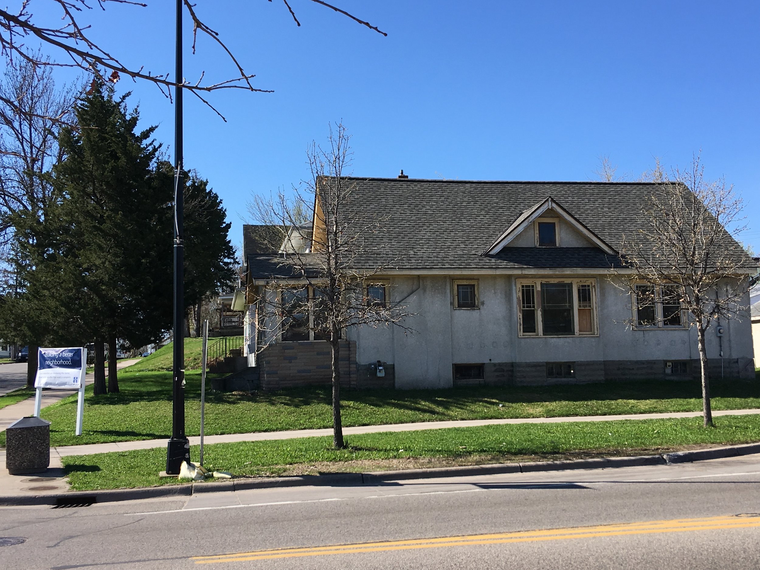
Hennepin County Building Better Neighborhoods bungalow on Lowry Avenue
Perhaps one of the most interesting finds on my run was a temporary bike lane installation on Irving Avenue N. The chalked bike lanes, seating areas, and plantings delineating the separation were put in place last June to demonstrate the intended permanent greenway. It appears the installation was successful as it was not removed after the 10 day run originally scheduled.

Irving Avenue N temporary bike lane installation
Near the end of my journey on Lowry Avenue was a large group of individuals armed with rakes and shovels, preparing to start their Earth Day activities. It appeared they were getting the Cleveland Neighborhood Garden ready for spring plantings. There were no shortage of organized Earth Day clean ups. I must have run past six different groups scattered along all sections of my route. One group pulled out two large comforters from the east bank of the Mississippi.
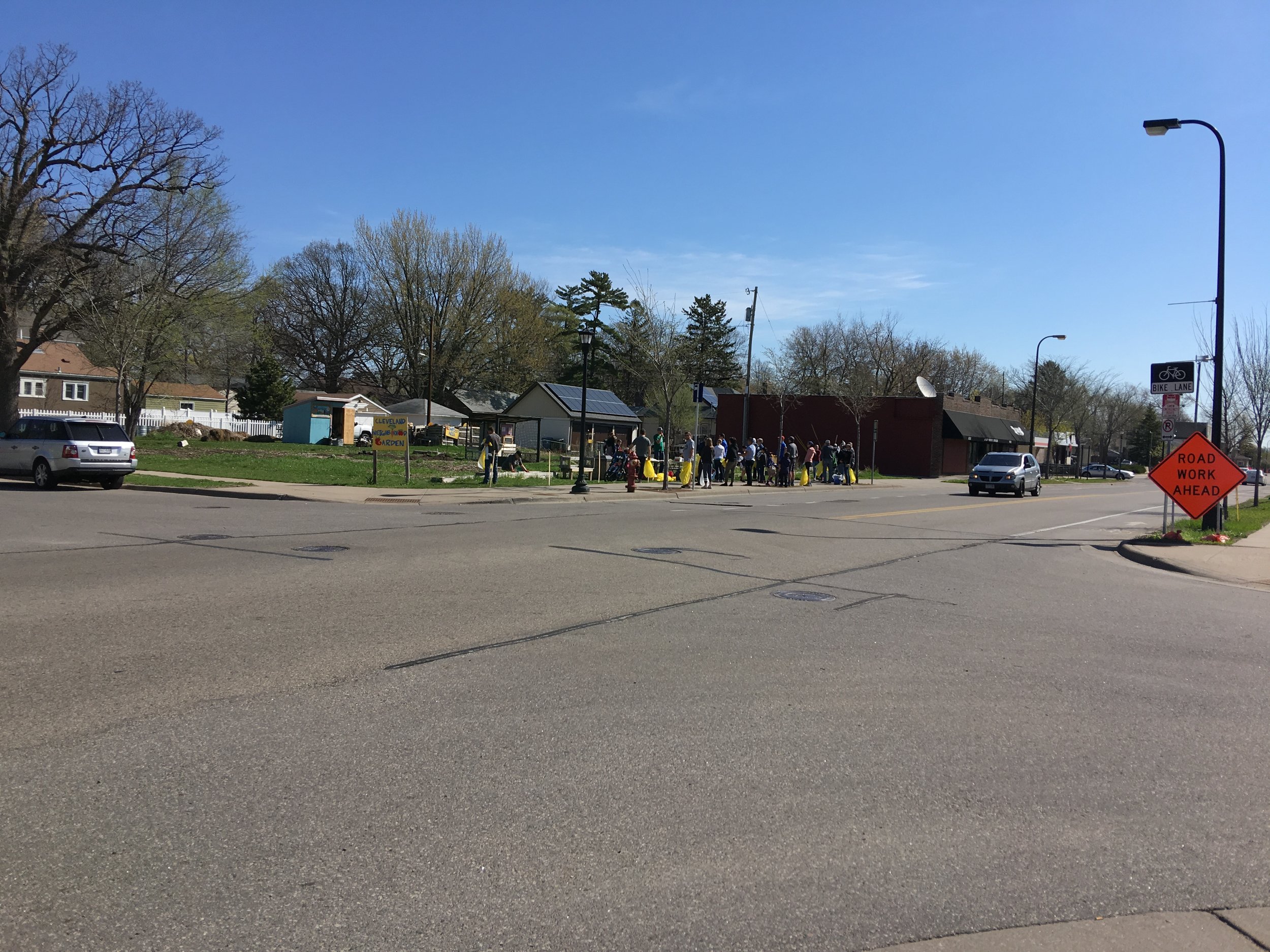
Cleveland Neighborhood Garden clean up crew
The western boundary of my journey was Theodore Wirth Parkway, named after one of the Minneapolis Park Board greats that helped shape the system of parks and trails into what it is today. The paved trail offers separate lanes for bikers and pedestrians, leading through open space, a golf course, rivers, and historic neighborhoods. It is always amazing to find pockets in the heart of the city filled with streams, woods, and wildlife, void of the sounds of traffic and activity.

Theodore Wirth Parkway pedestrian trail
The southern end of my journey was the Plymouth Avenue bridge, my last opportunity to cross back into Northeast before the St. Anthony Falls area. Plymouth Avenue west of the Mississippi River is lined with infill town home and apartment complex projects. Their recent completion is visible in the dirt yards and silt fences still in place. What was different about Plymouth Avenue compared to Lowry Avenue along the same stretch is a lack of businesses on Plymouth. Whereas Lowry Avenue was lined with old brick buildings housing a variety of uses, Plymouth Avenue was home to the occasional gas station or liquor store, mostly filled with medium to high density housing.
Crossing back over the Plymouth Avenue bridge I noticed a new trail running north along the east bank of the Mississippi River and decided to follow it. The Upper River trail is the latest in the Minneapolis Park Boards attempts to extend the trail network north. It begins where the existing trail leaves off at the Plymouth Avenue bridge and meanders behind the old Grain Belt Brewery, ending at the Burlington train tracks at about 16th Avenue NE. The new trail has separate pedestrian and bicycle paths and is well lit with artwork and a plaza space behind the Grain Belt complex.

New section of the Upper River trail system with the plaza space on the river
While the 20 mile run nearly did me in, it was well worth it. Had I driven this route, I would not have seen all the new activity and development taking place throughout my city. I would have missed the new section of the east bank trail, probably would not have caught the bungalow project on Lowry, and would not have given a second thought to the new apartment building at Lyndale Avenue. Exploring cities is best done on foot, or a slow bike ride. Hopefully I qualify for Boston in June so I have another reason to keep exploring my city from the view of a pedestrian.


